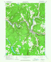
1965 Map of Roscoe
USGS Topo · Published 1967About this map
The confluence of the Beaver Kill and Willowemoc Creek at Roscoe serves as the focal point of this mid-1960s survey, illustrating a landscape defined by world-renowned trout streams and forest conservation. The village of Rockland and the nearby Cooks Falls appear along the river corridors, while the higher elevations are protected within the Catskill State Park and various State Forest Preserve tracts. This era shows the development of leisure and transit in the western Catskills, from the Landing Strip near the county line to the Skytop Airport in the south near Tennanah Lake. Researchers can find evidence of local industry at several Quarry sites and trace established community centers at Riverside Cem and Rockland Cem. The underlying infrastructure of the West Delaware Aqueduct cuts through the northern hills of Colchester, marking the region's importance to the broader state water system.
Find a feature on this map
48 named features on this map. Tap any name to fly to it.
Don’t see what you’re looking for? This feature index may not catch every label — zoom into the map to look around manually.
Map Details
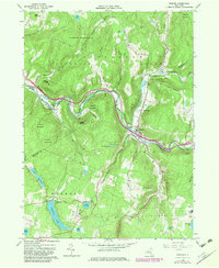
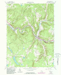
Editions of this 1965 Roscoe Map
3 editions found
Other maps of this area

1920 · Long Eddy
USGS Topo · 1:62,500

1921 · Long Eddy
USGS Topo · 1:48,000

1921 · Livingston Manor
USGS Topo · 1:62,500

1922 · Andes
USGS Topo · 1:62,500

1923 · Long Eddy
USGS Topo · 1:62,500

1923 · Walton
USGS Topo · 1:48,000

1923 · Livingston Manor
USGS Topo · 1:62,500

1924 · Andes
USGS Topo · 1:62,500

1925 · Walton
USGS Topo · 1:62,500

1943 · Honesdale
USGS Topo · 1:125,000