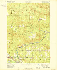
1951 Map of Roscommon North
USGS Topo · Published 1951About this map
South Branch Au Sable River winds through this mid-century landscape, carving a path through the intersection of the Grayling State Forest, Huron National Forest, and Higgins Lake State Forest. The area near the Crawford and Roscommon county line reveals a mix of recreational and industrial use, featuring the Bay City Hunting and Fishing Club and several small settlements. North of Roscommon, researchers can find the Pioneer Cemetery and Deerheart Valley, while scattered ruins and a sawmill suggest the changing footprint of local timber and settlement. The presence of the South Branch Ranch and Bell Top Lodge indicates a region deeply tied to northern Michigan's tradition of outdoor sporting and land management during the post-war era.
Find a feature on this map
20 named features on this map. Tap any name to fly to it.
Don’t see what you’re looking for? This feature index may not catch every label — zoom into the map to look around manually.
Map Details
Editions of this 1951 Roscommon North Map
2 editions found
Other maps of this area

1949 · Grayling
USGS Topo · 1:62,500

1950 · Grayling
USGS Topo · 1:24,000

1950 · Roscommon North
USGS Topo · 1:24,000

1951 · Wakeley Lake
USGS Topo · 1:24,000

1951 · Grayling
USGS Topo · 1:24,000

1951 · Roscommon North
USGS Topo · 1:24,000

1951 · Pere Cheney
USGS Topo · 1:24,000

1954 · Traverse City
USGS Topo · 1:250,000

1958 · Traverse City
USGS Topo · 1:250,000

1963 · Roscommon South
USGS Topo · 1:24,000