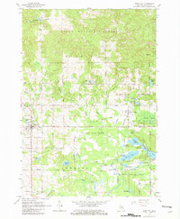
1965 Map of Rose City
USGS Topo · Published 1982About this map
Rose City and the neighboring community of Lupton anchor this 1965 mid-century look at Ogemaw County, where the transition from industrial timbering to conservation and recreation is clearly visible. The map records the Old Houghton Railroad Grade and another Old Railroad Grade cutting through the landscape, remnants of the logging infrastructure that once dominated this region. These former rail lines are juxtaposed with the sprawling boundaries of the Huron National Forest and the Au Sable State Forest, which now preserve the wooded hills and numerous water bodies like Grousehaven Lake and the oddly-named Devils Washbasin.
Find a feature on this map
68 named features on this map. Tap any name to fly to it.
Don’t see what you’re looking for? This feature index may not catch every label — zoom into the map to look around manually.
Map Details
Editions of this 1965 Rose City Map
3 editions found
Other maps of this area

1954 · Traverse City
USGS Topo · 1:250,000

1954 · Tawas City
USGS Topo · 1:250,000

1958 · Traverse City
USGS Topo · 1:250,000

1958 · Tawas City
USGS Topo · 1:250,000

1965 · Damon
USGS Topo · 1:24,000

1965 · West Branch
USGS Topo · 1:24,000

1965 · Selkirk
USGS Topo · 1:24,000

1965 · Rose City
USGS Topo · 1:24,000

1968 · Sage Lake
USGS Topo · 1:24,000

1968 · South Branch
USGS Topo · 1:24,000