
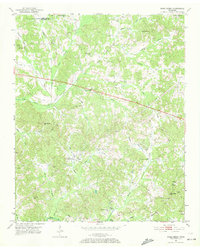
1951 Map of Rose Creek
USGS Topo · Published 1952About this map
Rural McNairy County at mid-century is defined by a dense network of upland drainage basins and small-plot agricultural settlements. The landscape is dominated by the Little Hatchie Creek and Rose Creek systems, which create a highly dissected topography of ridges and bottoms. Along these high points, community life centered on numerous small country houses of worship, such as New Bethel Ch, Mt Pleasant Ch, and Prices Chapel. The presence of one-room educational sites like Red Oak Sch and Sulphur Springs Sch underscores the decentralized nature of West Tennessee hill country life during the late 1940s and early 1950s. The northern edge of the sheet follows the Chester Co line, where family-named features like Curtis Hill and the Hendriz Branch indicate deep-seated generational ties to the local soil.
Find a feature on this map
32 named features on this map. Tap any name to fly to it.
Don’t see what you’re looking for? This feature index may not catch every label — zoom into the map to look around manually.
Map Details
Editions of this 1951 Rose Creek Map
3 editions found
Other maps of this area

1936 · Purdy
USGS Topo · 1:24,000

1936 · Mt. Peter
USGS Topo · 1:24,000

1949 · Mt. Peter
USGS Topo · 1:24,000

1949 · Purdy
USGS Topo · 1:24,000

1950 · Pocahontas
USGS Topo · 1:24,000

1950 · Hornsby
USGS Topo · 1:24,000

1951 · Hornsby
USGS Topo · 1:24,000

1951 · Chewalla
USGS Topo · 1:24,000

1951 · Guys
USGS Topo · 1:24,000

1952 · Pocahontas
USGS Topo · 1:24,000