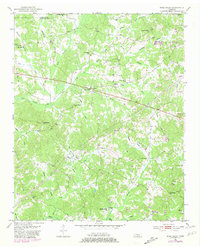
1951 Map of Rose Creek
USGS Topo · Published 1981About this map
Little Hatchie Creek and its many tributaries, including Rose Creek and Keith Branch, define this rural Tennessee landscape at the boundary of Chester Co and MC Nairy Co. The settlement pattern reflects a deeply rooted community of small farms and crossroads, anchored by a high density of country churches such as Prices Chapel and Mt Gilead Ch. This mid-century survey reveals the social infrastructure of the time, with local education sites like Red Oak Sch and Sulphur Springs Sch still serving as primary landmarks.
Find a feature on this map
38 named features on this map. Tap any name to fly to it.
Don’t see what you’re looking for? This feature index may not catch every label — zoom into the map to look around manually.
Map Details
Editions of this 1951 Rose Creek Map
3 editions found
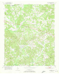
Other maps of this area

1936 · Purdy
USGS Topo · 1:24,000

1936 · Mt. Peter
USGS Topo · 1:24,000

1949 · Mt. Peter
USGS Topo · 1:24,000

1949 · Purdy
USGS Topo · 1:24,000

1950 · Pocahontas
USGS Topo · 1:24,000

1950 · Hornsby
USGS Topo · 1:24,000

1951 · Hornsby
USGS Topo · 1:24,000

1951 · Chewalla
USGS Topo · 1:24,000

1951 · Guys
USGS Topo · 1:24,000

1951 · Rose Creek
USGS Topo · 1:24,000