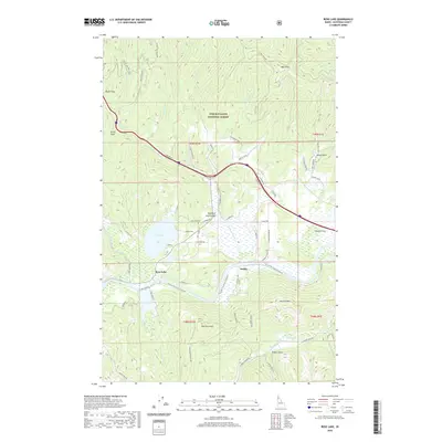
2020 Map of Rose Lake
USGS Topo · Published 2020About this map
Rose Lake and the winding Coeur d'Alene River form the heart of this landscape within the Coeur d'Alene National Forest. The map shows a transition from the narrow confines of Fourth of July Canyon to the broader valley where the river meets Mission Flats. This geography shaped early transit and settlement patterns, with the local economy tied to the river and rail corridors. Small clusters of development at Dudley and Rose Lake are supported by a network of timber and access roads like S Black Rock Rd and S Fourth of July Creek Rd.
Find a feature on this map
73 named features on this map. Tap any name to fly to it.
Don’t see what you’re looking for? This feature index may not catch every label — zoom into the map to look around manually.
Map Details
Editions of this 2020 Rose Lake Map
This is the sole edition of this map. No revisions or reprints were ever made.
Other maps of this area

1903 · Rathdrum
USGS Topo · 1:125,000

1909 · Cataldo
USGS Topo · 1:125,000

1911 · Cataldo
USGS Topo · 1:125,000

1950 · Rochat Peak
USGS Topo · 1:24,000

1950 · Twin Crags
USGS Topo · 1:24,000

1952 · Rochat Peak
USGS Topo · 1:24,000

1952 · Twin Crags
USGS Topo · 1:24,000

1955 · Spokane
USGS Topo · 1:250,000

1957 · St. Maries
USGS Topo · 1:62,500

1957 · Kingston
USGS Topo · 1:62,500