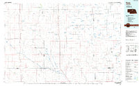
1985 Map of Rose
USGS Topo · Published 1985About this map
Calamus River and the Elkhorn River headwaters define the hydrography of this high plains region, where vast networks of lakes and wetlands dot the Sandhills landscape. The small rural settlements of Raven, Duff, and Rose anchor the sparse interior, connected by the north-south corridor of US Highway 183. This planimetric survey reveals a land organized by ranching and water management, featuring notable basins like Pony Lake, Goose Lake, and Wolf Lake. Landforms such as Paramount Valley and Gracie Flats represent the distinct topographic depressions common to North Central Nebraska. The map is a meticulous record of section lines and county boundaries, documenting the intersection of Rock, Brown, Holt, Loup, and Garfield counties during the mid-1980s.
Find a feature on this map
74 named features on this map. Tap any name to fly to it.
Don’t see what you’re looking for? This feature index may not catch every label — zoom into the map to look around manually.
Map Details
Editions of this 1985 Rose Map
2 editions found
Other maps of this area

1949 · Koshopah
USGS Topo · 1:62,500

1950 · Wood Lake
USGS Topo · 1:62,500

1951 · Dunning
USGS Topo · 1:62,500

1951 · Moon Lake
USGS Topo · 1:62,500

1951 · Koshopah
USGS Topo · 1:62,500

1952 · Brewster
USGS Topo · 1:24,000

1952 · Taylor NW
USGS Topo · 1:24,000

1952 · Almeria NE
USGS Topo · 1:24,000

1952 · Burwell NE
USGS Topo · 1:24,000

1952 · Almeria NW
USGS Topo · 1:24,000