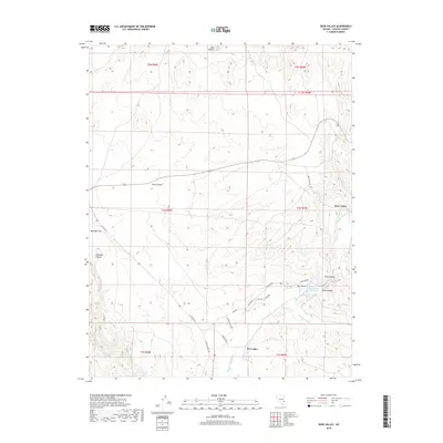
2018 Map of Rose Valley
USGS Topo · Published 2018About this map
Rose Valley and Dry Valley are the central settlements of this high-desert landscape in Lincoln County, where life is dictated by the seasonal flow of water through deep-cut washes. The northern terrain is defined by the Red Buttes and the long, linear drainage of Long Canyon, while the southern reaches reveal the critical water infrastructure of the Echo Canyon Reservoir.
Find a feature on this map
26 named features on this map. Tap any name to fly to it.
Don’t see what you’re looking for? This feature index may not catch every label — zoom into the map to look around manually.
Map Details
Editions of this 2018 Rose Valley Map
This is the sole edition of this map. No revisions or reprints were ever made.
Other maps of this area

1885 · Pioche
USGS Topo · 1:250,000

1886 · Pioche
USGS Topo · 1:250,000

1921 · NW 1/4 Panaca
USGS Topo · 1:48,000

1953 · Pioche
USGS Topo · 1:24,000

1954 · Caliente
USGS Topo · 1:250,000

1956 · Lund
USGS Topo · 1:250,000

1959 · Caliente
USGS Topo · 1:250,000

1960 · Lund
USGS Topo · 1:250,000
1970 · Mt. Wilson SW
USGS Topo · 1:24,000

1970 · Pierson Summit
USGS Topo · 1:24,000