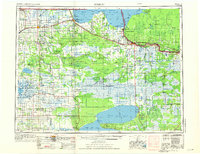
1954 Map of Roseau
USGS Topo · Published 1976About this map
Lake of the Woods and the Rainy River define the international boundary in this 1954 revision, which captures the expansive northern Minnesota wilderness before extensive modern development. The landscape is dominated by massive protected areas, including the Beltrami Island State Forest and the Red Lake State Forest, alongside the northern portion of the Red Lake Indian Reservation surrounding Upper Red Lake.
Find a feature on this map
142 named features on this map. Tap any name to fly to it.
Don’t see what you’re looking for? This feature index may not catch every label — zoom into the map to look around manually.
Map Details
Editions of this 1954 Roseau Map
2 editions found

Other maps of this area

1918 · Goos
USGS Topo · 1:62,500

1918 · Buffalo Bay
USGS Topo · 1:62,500

1918 · Winterroad
USGS Topo · 1:62,500

1918 · Roosevelt
USGS Topo · 1:62,500

1918 · Rollis
USGS Topo · 1:62,500

1918 · F
USGS Topo · 1:62,500

1918 · Williams
USGS Topo · 1:62,500

1918 · Pencer
USGS Topo · 1:62,500

1918 · Terrebonne
USGS Topo · 1:62,500

1918 · Roseau
USGS Topo · 1:62,500