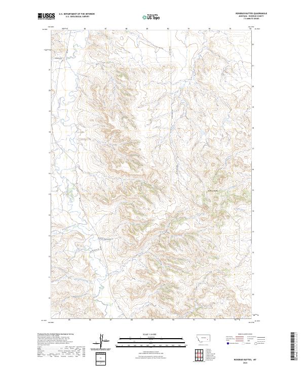
2024 Map of Rosebud Buttes
USGS Topo · Published 2024About this map
Rosebud Buttes anchor this portion of the Montana landscape, standing as a prominent geological feature in Rosebud County. The terrain is defined by a dendritic network of drainages, where the waters of Rosebud Creek and Butte Creek have carved a complex series of ridges and coulees. This contemporary map documents the modern rural infrastructure of the region, including local access routes like Wildcat Rd and Alder Ranch Rd. Small-scale residential development is evident along Rosebud Creek Estates Ln, showing the slow expansion of settlement near West Rosebud Creek. The cartography also traces numerous smaller watercourses, such as Indian Creek and Runaway Creek, which highlight the intricate hydrology of this high-plains environment within the Public Land Survey System grids of T5N and T6N.
Find a feature on this map
19 named features on this map. Tap any name to fly to it.
Don’t see what you’re looking for? This feature index may not catch every label — zoom into the map to look around manually.
Map Details
Editions of this 2024 Rosebud Buttes Map
This is the sole edition of this map. No revisions or reprints were ever made.
Other maps of this area

1954 · Forsyth
USGS Topo · 1:250,000

1957 · Forsyth
USGS Topo · 1:250,000

1958 · Forsyth
USGS Topo · 1:250,000

1968 · Orinoco
USGS Topo · 1:24,000

1968 · Rosebud
USGS Topo · 1:24,000

1968 · Thurlow
USGS Topo · 1:24,000

1971 · Smith Creek NE
USGS Topo · 1:24,000
1971 · Indian Creek
USGS Topo · 1:24,000
1971 · Crain Place
USGS Topo · 1:24,000
1971 · Mc Kerlich Creek
USGS Topo · 1:24,000