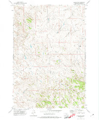
1971 Map of Crain Place
USGS Topo · Published 1974About this map
Crain Place sits within a network of drainage basins in Rosebud County, where the landscape is defined by the winding paths of Eagle Creek and its many tributaries. This 1971 field-checked survey reveals a ranching and resource-driven environment, characterized by seasonal water sources such as Barrot Spring and Spring Creek. The terrain is etched with a Jeep Trail and several unimproved roads that navigate between the creek beds, including Cottonwood Creek in the north and Goodman Creek in the south. An isolated Drill Hole in the southern section suggests the area's history of mineral or geological exploration. The presence of Twelvemile Creek and Beaver Creek further illustrates the complex watershed system that supported the remote operations of this Montana rangeland during the early 1970s.
Find a feature on this map
10 named features on this map. Tap any name to fly to it.
Don’t see what you’re looking for? This feature index may not catch every label — zoom into the map to look around manually.
Map Details
Editions of this 1971 Crain Place Map
This is the sole edition of this map. No revisions or reprints were ever made.
Other maps of this area

1954 · Hardin
USGS Topo · 1:250,000

1954 · Forsyth
USGS Topo · 1:250,000

1957 · Hardin
USGS Topo · 1:250,000

1957 · Forsyth
USGS Topo · 1:250,000

1958 · Forsyth
USGS Topo · 1:250,000

1958 · Hardin
USGS Topo · 1:250,000
1969 · Miller Creek SW
USGS Topo · 1:24,000
1969 · Miller Creek NW
USGS Topo · 1:24,000
1971 · Brandenberg NW
USGS Topo · 1:24,000

1971 · Hammond Draw NW
USGS Topo · 1:24,000