
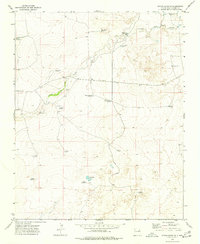
1966 Map of Rosebud
USGS Topo · Published 1968About this map
Rosebud and the surrounding ranching landscape of Harding County are defined by a sophisticated network of water infrastructure and seasonal drainages. During the mid-1960s, this area relied heavily on specifically named water sources like Brune Well and Matis Well to support livestock and small settlements. The importance of the cattle industry is evident in the presence of specialized locations such as the Shipping Pen Well and Feed Pen Well, which provided essential staging points for local agriculture. The terrain is marked by the Arroyo de la Cejita and Hackberry Springs, showing how natural hydrology dictated the placement of roads and homesteads. Local history is anchored by the Rosebud Cemetery, which stands as a quiet reminder of the families who settled this high plains region. Further south, Rosebud Farms indicates a transition toward organized agricultural plots in an otherwise open ranching environment.
Find a feature on this map
15 named features on this map. Tap any name to fly to it.
Don’t see what you’re looking for? This feature index may not catch every label — zoom into the map to look around manually.
Map Details
Editions of this 1966 Rosebud Map
This is the sole edition of this map. No revisions or reprints were ever made.
Other maps of this area

1954 · Tucumcari
USGS Topo · 1:250,000

1958 · Tucumcari
USGS Topo · 1:250,000

1966 · Ione
USGS Topo · 1:24,000

1966 · Hayden
USGS Topo · 1:24,000

1966 · Cherokee Valley
USGS Topo · 1:24,000

1966 · Cottonwood Springs
USGS Topo · 1:24,000

1966 · Mc Cloy Ranch
USGS Topo · 1:24,000

1969 · Gallegos NE
USGS Topo · 1:24,000

1973 · Bueyeros NE
USGS Topo · 1:24,000
1973 · Indian Bathtub
USGS Topo · 1:24,000