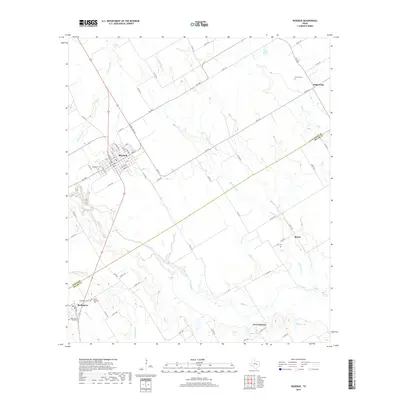
2019 Map of Rosebud
USGS Topo · Published 2019About this map
Rosebud serves as the central hub of this agricultural region where the boundary between Falls and Milam counties meets. The settlement pattern follows a network of farm-to-market roads and county routes that connect outlying communities like Wilderville and Briary. Water management is a defining characteristic of the landscape, evidenced by the numerous tributaries such as Pond Creek and Big Briary Creek, along with several small lakes including Hauk Lake and Gibson Lake.
Find a feature on this map
74 named features on this map. Tap any name to fly to it.
Don’t see what you’re looking for? This feature index may not catch every label — zoom into the map to look around manually.
Map Details
Editions of this 2019 Rosebud Map
This is the sole edition of this map. No revisions or reprints were ever made.
Other maps of this area

1885 · Taylor
USGS Topo · 1:125,000

1887 · Taylor
USGS Topo · 1:125,000

1892 · Temple
USGS Topo · 1:125,000

1894 · Taylor
USGS Topo · 1:125,000

1954 · Waco
USGS Topo · 1:250,000

1954 · Austin
USGS Topo · 1:250,000

1955 · Waco
USGS Topo · 1:250,000

1961 · Baileyville
USGS Topo · 1:24,000

1962 · Maysfield
USGS Topo · 1:24,000

1962 · Rosebud
USGS Topo · 1:24,000