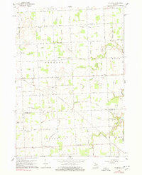
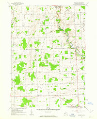
1961 Map of Roseburg
USGS Topo · Published 1978About this map
Roseburg and the rural townships of Buel, Fremont, and Worth define this agricultural landscape in Sanilac County. Surveyed at the start of the 1960s, the area is characterized by an extensive system of drainage infrastructure, such as the William Doan Drain and Hunt Drain, which supported the conversion of the local terrain into productive farmland. The map reveals a high density of small rural schools like Mitchell Sch and Thorley Sch along with local landmarks like the Townhall, reflecting a period when small community centers still anchored the countryside. In the southeast, the terrain shifts near the Port Huron State Game Area as the Black River snakes through the border of Grant township, where several Gravel Pits indicate active local mineral extraction along the riverbanks.
Find a feature on this map
52 named features on this map. Tap any name to fly to it.
Don’t see what you’re looking for? This feature index may not catch every label — zoom into the map to look around manually.
Map Details
Editions of this 1961 Roseburg Map
2 editions found
Other maps of this area

1954 · Flint
USGS Topo · 1:250,000

1958 · Flint
USGS Topo · 1:250,000
1961 · Ruby
USGS Topo · 1:24,000

1961 · Roseburg
USGS Topo · 1:24,000
1961 · Avoca
USGS Topo · 1:24,000
1961 · Jeddo
USGS Topo · 1:24,000
1961 · Brockway
USGS Topo · 1:24,000

1961 · Yale
USGS Topo · 1:24,000

1963 · Peck
USGS Topo · 1:24,000

1963 · Croswell
USGS Topo · 1:24,000