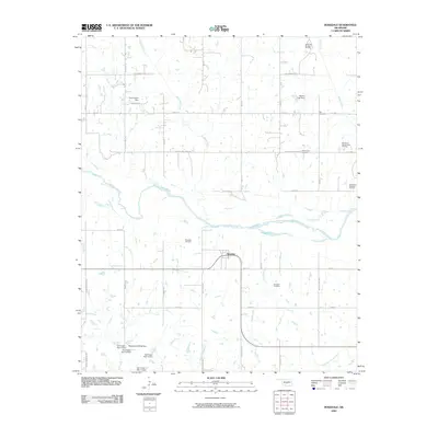
2009 Map of Rosedale
USGS Topo · Published 2009About this map
Rosedale serves as the central hub of this Oklahoma landscape, situated just south of a sweeping bend in the Canadian River. The area’s industrial character is defined by widespread energy extraction, notably within the Rosedale Oil Field and the North Red Springs Oil Field to the north. These oil fields are integrated into a rural grid defined by roads with descriptive local names like Flat Armadillo Rd and Edge of the Earth Rd.
Find a feature on this map
47 named features on this map. Tap any name to fly to it.
Don’t see what you’re looking for? This feature index may not catch every label — zoom into the map to look around manually.
Map Details
Editions of this 2009 Rosedale Map
This is the sole edition of this map. No revisions or reprints were ever made.
Other maps of this area

1893 · Norman
USGS Topo · 1:62,500

1898 · Purcell
USGS Topo · 1:125,000

1898 · Pauls Valley
USGS Topo · 1:125,000

1902 · Pauls Valley
USGS Topo · 1:125,000

1910 · McComb
USGS Topo · 1:62,500

1936 · Norman
USGS Topo · 1:62,500

1954 · Oklahoma City
USGS Topo · 1:250,000

1957 · Ardmore
USGS Topo · 1:250,000

1957 · Oklahoma City
USGS Topo · 1:250,000
1958 · Tribbey
USGS Topo · 1:24,000