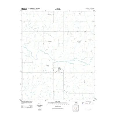
2013 Map of Rosedale
USGS Topo · Published 2013About this map
The Canadian River meanders across the central landscape of McClain County, shaping the rural character of this northern Oklahoma region. Small communities and isolated oil patches define the local economy, with the Rosedale Oil Field and the North Red Springs Oil Field illustrating the area's industrial footprint amidst agricultural lands. The settlement of Rosedale serves as a local hub, featuring a concentrated street grid with Main St, Walnut St, and Chickasaw Ave.
Find a feature on this map
53 named features on this map. Tap any name to fly to it.
Don’t see what you’re looking for? This feature index may not catch every label — zoom into the map to look around manually.
Map Details
Editions of this 2013 Rosedale Map
This is the sole edition of this map. No revisions or reprints were ever made.
Other maps of this area

1893 · Norman
USGS Topo · 1:62,500

1898 · Purcell
USGS Topo · 1:125,000

1898 · Pauls Valley
USGS Topo · 1:125,000

1902 · Pauls Valley
USGS Topo · 1:125,000

1910 · McComb
USGS Topo · 1:62,500

1936 · Norman
USGS Topo · 1:62,500

1954 · Oklahoma City
USGS Topo · 1:250,000

1957 · Ardmore
USGS Topo · 1:250,000

1957 · Oklahoma City
USGS Topo · 1:250,000
1958 · Tribbey
USGS Topo · 1:24,000