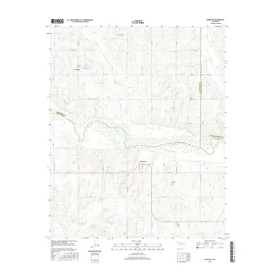
2016 Map of Rosedale
USGS Topo · Published 2016About this map
The Canadian River meanders across this landscape, marking the natural boundary between McClain, Cleveland, and Pottawatomie counties. Small rural settlements like Rosedale and Corbett are central to the area's geography, connected by a network of gravel and local roads with evocative names such as Edge of the Earth Rd and Flat Armadillo Rd. This survey documents a quiet interior of central Oklahoma, where the landscape is defined more by its local cemeteries and water management than by heavy industry.
Find a feature on this map
54 named features on this map. Tap any name to fly to it.
Don’t see what you’re looking for? This feature index may not catch every label — zoom into the map to look around manually.
Map Details
Editions of this 2016 Rosedale Map
This is the sole edition of this map. No revisions or reprints were ever made.
Other maps of this area

1893 · Norman
USGS Topo · 1:62,500

1898 · Purcell
USGS Topo · 1:125,000

1898 · Pauls Valley
USGS Topo · 1:125,000

1902 · Pauls Valley
USGS Topo · 1:125,000

1910 · McComb
USGS Topo · 1:62,500

1936 · Norman
USGS Topo · 1:62,500

1954 · Oklahoma City
USGS Topo · 1:250,000

1957 · Ardmore
USGS Topo · 1:250,000

1957 · Oklahoma City
USGS Topo · 1:250,000
1958 · Tribbey
USGS Topo · 1:24,000