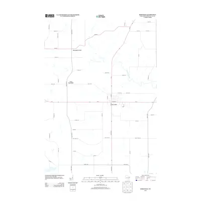
2013 Map of Rosendale
USGS Topo · Published 2013About this map
Rosendale stands at the crossroads of east-central Wisconsin, where the intersection of Wi-23 and State Road 26 forms the heart of this agricultural community. The landscape is defined by its rectilinear grid of rural routes, including Olden Rd and Rose Eld Rd, which serve a series of interconnected hamlets. Beyond the main village, West Rosendale and Rosendale Center reflect the historical pattern of dispersed settlement typical of Fond du Lac County’s farming heritage.
Find a feature on this map
43 named features on this map. Tap any name to fly to it.
Don’t see what you’re looking for? This feature index may not catch every label — zoom into the map to look around manually.
Map Details
Editions of this 2013 Rosendale Map
This is the sole edition of this map. No revisions or reprints were ever made.
Other maps of this area

1916 · Ripon
USGS Topo · 1:48,000

1918 · Ripon
USGS Topo · 1:62,500

1955 · Waupun
USGS Topo · 1:62,500

1955 · Fox Lake
USGS Topo · 1:62,500

1956 · Ripon
USGS Topo · 1:62,500

1956 · Rosendale
USGS Topo · 1:62,500

1957 · Madison
USGS Topo · 1:250,000

1960 · Madison
USGS Topo · 1:250,000

1975 · Waupun NW
USGS Topo · 1:24,000
1975 · Waupun NE
USGS Topo · 1:24,000