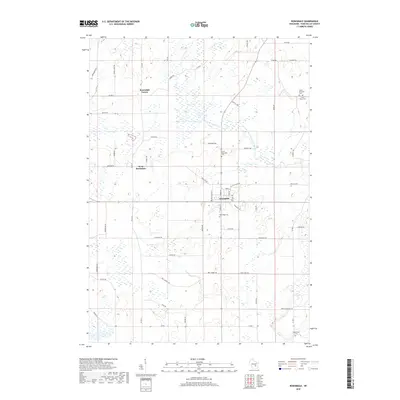
2018 Map of Rosendale
USGS Topo · Published 2018About this map
The agricultural landscape of Fond du Lac County is anchored here by the village of Rosendale, a significant regional crossroads defined by the intersection of major county routes and the upper reaches of the West Branch Fond Du Lac River. This survey captures the spatial relationship between the primary village and outlying hamlets such as West Rosendale and Rosendale Center, reflecting a settlement pattern typical of Wisconsin dairy country. For genealogists and local historians, the sheet provides precise locations for several rural burial grounds, including Rosendale Cem and North Rosendale Cem. The terrain is characterized by a dense network of country roads like Triple Kay RD and Willow Creek Rd, which carve through a landscape dotted with numerous wetlands and small water bodies that feed into the local river system.
Find a feature on this map
55 named features on this map. Tap any name to fly to it.
Don’t see what you’re looking for? This feature index may not catch every label — zoom into the map to look around manually.
Map Details
Editions of this 2018 Rosendale Map
This is the sole edition of this map. No revisions or reprints were ever made.
Other maps of this area

1916 · Ripon
USGS Topo · 1:48,000

1918 · Ripon
USGS Topo · 1:62,500

1955 · Waupun
USGS Topo · 1:62,500

1955 · Fox Lake
USGS Topo · 1:62,500

1956 · Ripon
USGS Topo · 1:62,500

1956 · Rosendale
USGS Topo · 1:62,500

1957 · Madison
USGS Topo · 1:250,000

1960 · Madison
USGS Topo · 1:250,000

1975 · Waupun NW
USGS Topo · 1:24,000
1975 · Waupun NE
USGS Topo · 1:24,000