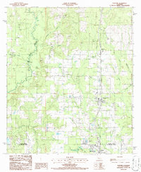
1986 Map of Rosepine
USGS Topo · Published 1986About this map
The boundary between Vernon Parish and Beauregard Parish bisects this mid-1980s landscape, where the Kansas City Southern railroad serves as a central artery for the growing timber and transport corridor of western Louisiana. The town of Rosepine sits at the heart of the map, flanked by smaller settlements like Pinewood to the north and the industrial outskirts of De Ridder and Ludington to the south.
Find a feature on this map
24 named features on this map. Tap any name to fly to it.
Don’t see what you’re looking for? This feature index may not catch every label — zoom into the map to look around manually.
Map Details
Editions of this 1986 Rosepine Map
2 editions found
Other maps of this area

1941 · Leesville
USGS Topo · 1:62,500

1941 · Slagle
USGS Topo · 1:62,500

1943 · Leesville
USGS Topo · 1:62,500

1944 · Slagle
USGS Topo · 1:62,500

1946 · Leesville
USGS Topo · 1:62,500

1947 · Pujo
USGS Topo · 1:31,680

1947 · DeRidder
USGS Topo · 1:31,680

1947 · Rosepine
USGS Topo · 1:31,680

1947 · Knight
USGS Topo · 1:31,680

1947 · Ikes
USGS Topo · 1:31,680