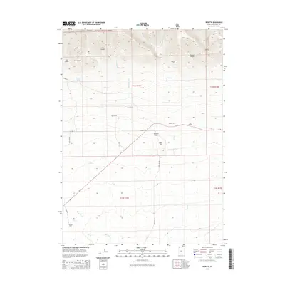
2014 Map of Rosette
USGS Topo · Published 2014About this map
Sawtooth National Forest dominates the northern reaches of this high-desert landscape, where the terrain drops sharply from steep peaks into a network of canyons including Bills Canyon and Duncan Canyon. The central valley is defined by the settlement of Rosette and nearby Park Valley, situated along the corridor of Ut-30. This area reflects a long-standing ranching economy, with named family sites such as Palmer Ranch, Morris Ranch, and Kunzlers Ranch positioned near vital water sources like Long Birch Cr and Dove Cr. The southern portion of the map transitions toward Cedar Hill and the seasonal drainages of Black Hills Cr, illustrating the reliance of these isolated northern Utah outposts on the ephemeral streams flowing from the northern mountains.
Find a feature on this map
34 named features on this map. Tap any name to fly to it.
Don’t see what you’re looking for? This feature index may not catch every label — zoom into the map to look around manually.
Map Details
Editions of this 2014 Rosette Map
This is the sole edition of this map. No revisions or reprints were ever made.
Other maps of this area

1954 · Brigham City
USGS Topo · 1:250,000

1958 · Brigham City
USGS Topo · 1:250,000

1959 · Park Valley
USGS Topo · 1:62,500

1959 · Yost
USGS Topo · 1:62,500

1962 · Brigham City
USGS Topo · 1:250,000
1971 · Runswick Wash
USGS Topo · 1:24,000

1971 · Warm Spring Hills
USGS Topo · 1:24,000
1971 · Russian Knoll
USGS Topo · 1:24,000

1987 · Grouse Creek
USGS Topo · 1:100,000
1990 · Dennis Hill
USGS Topo · 1:24,000