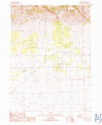
1990 Map of Rosette
USGS Topo · Published 1990About this map
The Raft River Mountains dominate this high-desert landscape in northern Utah, where the southern reaches of the Sawtooth National Forest descend into the valley. The small settlement of Rosette sits as a lonely outpost amidst a network of 4WD trails and seasonal drainages. The area’s economic history is etched into the terrain through various extraction sites, including a Mine Shaft in the north and a Gravel Pit near the town center.
Find a feature on this map
31 named features on this map. Tap any name to fly to it.
Don’t see what you’re looking for? This feature index may not catch every label — zoom into the map to look around manually.
Map Details
Editions of this 1990 Rosette Map
This is the sole edition of this map. No revisions or reprints were ever made.
Other maps of this area

1954 · Brigham City
USGS Topo · 1:250,000

1958 · Brigham City
USGS Topo · 1:250,000

1959 · Park Valley
USGS Topo · 1:62,500

1959 · Yost
USGS Topo · 1:62,500

1962 · Brigham City
USGS Topo · 1:250,000
1971 · Runswick Wash
USGS Topo · 1:24,000

1971 · Warm Spring Hills
USGS Topo · 1:24,000
1971 · Russian Knoll
USGS Topo · 1:24,000

1987 · Grouse Creek
USGS Topo · 1:100,000
1990 · Dennis Hill
USGS Topo · 1:24,000