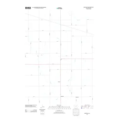
2013 Map of Roseville
USGS Topo · Published 2013About this map
Roseville and the surrounding township in Floyd County are defined by a rhythmic section-line grid of rural roads and the meandering drainage basins of Flood Cr and Beaver Cr. In this early 21st-century landscape, small rural clusters like Carney and Ulster persist as quiet landmarks within a high-intensity agricultural environment. The mapping reveals how local infrastructure, including north-south corridors like Jersey Ave and east-west routes like 200th St, organizes the territory around the drainage of Stewart Cr in the north. The proximity of Oakwood to the southeast corner highlights the sparse, distributed nature of settlements in this part of Iowa, where the road network strictly follows the public land survey system, carving the landscape into precise agricultural blocks.
Find a feature on this map
32 named features on this map. Tap any name to fly to it.
Don’t see what you’re looking for? This feature index may not catch every label — zoom into the map to look around manually.
Map Details
Editions of this 2013 Roseville Map
This is the sole edition of this map. No revisions or reprints were ever made.
Other maps of this area

1954 · Mason City
USGS Topo · 1:250,000

1954 · Waterloo
USGS Topo · 1:250,000

1955 · Waterloo
USGS Topo · 1:250,000

1957 · Mason City
USGS Topo · 1:250,000

1958 · Mason City
USGS Topo · 1:250,000

1971 · Rockford
USGS Topo · 1:24,000

1971 · Orchard
USGS Topo · 1:24,000

1971 · Rudd
USGS Topo · 1:24,000

1971 · Charles City
USGS Topo · 1:24,000

1971 · Nashua NW
USGS Topo · 1:24,000