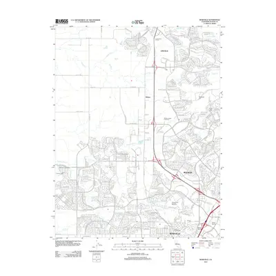
2012 Map of Roseville
USGS Topo · Published 2012About this map
Roseville and Rocklin anchor this detailed study of Placer County, documenting a period of significant suburban expansion and residential development. The landscape is defined by the transition from large agricultural holdings like W F Fiddyment Ranch and Spring Valley Ranch to organized municipal grids. Significant institutional landmarks include the William Jessup University campus and the Lincoln Rodeo Grounds in Lincoln, illustrating the area's mix of modern education and traditional community spaces. The natural drainage of the region remains visible through the winding paths of Miners Ravine, Secret Ravine, and Pleasant Grove Cr, which weave between established neighborhoods and newer developments. For local historians, the map preserves the location of Roseville Cem and smaller landmarks such as the Fiddyment Field Airport, providing a clear look at the region's infrastructure and land use just after the first decade of the 21st century.
Find a feature on this map
45 named features on this map. Tap any name to fly to it.
Don’t see what you’re looking for? This feature index may not catch every label — zoom into the map to look around manually.
Map Details
Editions of this 2012 Roseville Map
This is the sole edition of this map. No revisions or reprints were ever made.
Other maps of this area

1891 · Sacramento
USGS Topo · 1:125,000

1892 · Sacramento
USGS Topo · 1:125,000

1893 · Sacramento
USGS Topo · 1:125,000

1902 · Fairoaks
USGS Topo · 1:62,500

1910 · Sheridan
USGS Topo · 1:31,680

1910 · Lincoln
USGS Topo · 1:31,680

1910 · Roseville
USGS Topo · 1:31,680

1910 · Pleasant Grove
USGS Topo · 1:31,680

1911 · Arcade
USGS Topo · 1:31,680

1911 · Antelope
USGS Topo · 1:31,680