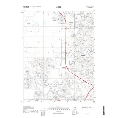
2018 Map of Roseville
USGS Topo · Published 2018About this map
Roseville and Rocklin anchor this 2018 survey, illustrating the modern expansion of these Placer County communities into the surrounding terrain. The landscape is defined by its drainages, including Miners Ravine and Secret Ravine in the south, while Auburn Ravine and Ingram Slough cut through the northern reaches near Lincoln. Educational and civic landmarks like William Jessup Univ and Heald College Roseville appear alongside the long-established Roseville Cem.
Find a feature on this map
35 named features on this map. Tap any name to fly to it.
Don’t see what you’re looking for? This feature index may not catch every label — zoom into the map to look around manually.
Map Details
Editions of this 2018 Roseville Map
This is the sole edition of this map. No revisions or reprints were ever made.
Other maps of this area

1891 · Sacramento
USGS Topo · 1:125,000

1892 · Sacramento
USGS Topo · 1:125,000

1893 · Sacramento
USGS Topo · 1:125,000

1902 · Fairoaks
USGS Topo · 1:62,500

1910 · Sheridan
USGS Topo · 1:31,680

1910 · Lincoln
USGS Topo · 1:31,680

1910 · Roseville
USGS Topo · 1:31,680

1910 · Pleasant Grove
USGS Topo · 1:31,680

1911 · Arcade
USGS Topo · 1:31,680

1911 · Antelope
USGS Topo · 1:31,680