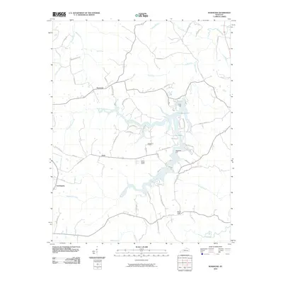
2010 Map of Rosewood
USGS Topo · Published 2010About this map
Lake Malone dominates the eastern portion of this Kentucky landscape, its winding fingers reaching into the surrounding terrain near Whiterock Cliff. The area is defined by a dense network of waterways including Rocky Clifty Creek and Sulphur Spring Creek, which dictate the placement of local roads and small settlements like Rosewood and Jason. The small airfield at Caring Wings Airport provides a modern navigational point amidst the traditional rural layout of farms and woodland. Genealogists may find value in the location of the McPherson Cemetery, situated north of the lake. The unusual place name of Tyewhoppety stands out in the western section, representing one of several localized hubs that anchor the many family-named roads like Dunmor Deerlick Rd and Myers Chapel Rd branching through the countryside.
Find a feature on this map
60 named features on this map. Tap any name to fly to it.
Don’t see what you’re looking for? This feature index may not catch every label — zoom into the map to look around manually.
Map Details
Editions of this 2010 Rosewood Map
This is the sole edition of this map. No revisions or reprints were ever made.
Other maps of this area

1911 · Drakesboro
USGS Topo · 1:48,000

1911 · Dunmor
USGS Topo · 1:48,000

1913 · Drakesboro
USGS Topo · 1:62,500

1914 · Dunmor
USGS Topo · 1:62,500

1951 · Lewisburg
USGS Topo · 1:24,000

1952 · Sharon Grove
USGS Topo · 1:24,000

1952 · Allegre
USGS Topo · 1:24,000

1952 · Greenville
USGS Topo · 1:24,000

1953 · Drakesboro
USGS Topo · 1:24,000

1953 · Rosewood
USGS Topo · 1:24,000