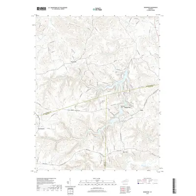
2019 Map of Rosewood
USGS Topo · Published 2019About this map
Lake Malone serves as the central geographic anchor for this section of Kentucky, where the borders of Muhlenberg, Todd, and Logan Counties converge. The intricate shoreline of Whiskey Bay and the presence of Whiterock Cliff highlight a landscape defined by significant elevation changes and carved watercourses. Small settlements like Rosewood, Jason, and Agnes are connected by a network of winding roads such as Rosewood Rd and Jason Ridge Rd, reflecting the rural residential patterns of the early 21st century.
Find a feature on this map
96 named features on this map. Tap any name to fly to it.
Don’t see what you’re looking for? This feature index may not catch every label — zoom into the map to look around manually.
Map Details
Editions of this 2019 Rosewood Map
This is the sole edition of this map. No revisions or reprints were ever made.
Other maps of this area

1911 · Drakesboro
USGS Topo · 1:48,000

1911 · Dunmor
USGS Topo · 1:48,000

1913 · Drakesboro
USGS Topo · 1:62,500

1914 · Dunmor
USGS Topo · 1:62,500

1951 · Lewisburg
USGS Topo · 1:24,000

1952 · Sharon Grove
USGS Topo · 1:24,000

1952 · Allegre
USGS Topo · 1:24,000

1952 · Greenville
USGS Topo · 1:24,000

1953 · Drakesboro
USGS Topo · 1:24,000

1953 · Rosewood
USGS Topo · 1:24,000