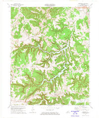
1972 Map of Rosewood
USGS Topo · Published 1974About this map
Lake Malone serves as the centerpiece of this West Kentucky landscape, where the borders of Muhlenberg, Todd, and Logan counties converge. The 1970s era topography shows the developed recreational areas of Lake Malone State Park, including the Campground and Picnic Area, set against a backdrop of deep hollows like Boggess Hollow and sheer features such as Whiterock Cliff. The map documents a network of rural settlements and family-named locations, from Rosewood and Jason to the uniquely named Tyewhoppety in the west.
Find a feature on this map
38 named features on this map. Tap any name to fly to it.
Don’t see what you’re looking for? This feature index may not catch every label — zoom into the map to look around manually.
Map Details
Editions of this 1972 Rosewood Map
This is the sole edition of this map. No revisions or reprints were ever made.
Other maps of this area

1911 · Drakesboro
USGS Topo · 1:48,000

1911 · Dunmor
USGS Topo · 1:48,000

1913 · Drakesboro
USGS Topo · 1:62,500

1914 · Dunmor
USGS Topo · 1:62,500

1951 · Lewisburg
USGS Topo · 1:24,000

1952 · Sharon Grove
USGS Topo · 1:24,000

1952 · Allegre
USGS Topo · 1:24,000

1952 · Greenville
USGS Topo · 1:24,000

1953 · Drakesboro
USGS Topo · 1:24,000

1953 · Rosewood
USGS Topo · 1:24,000