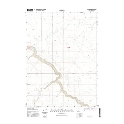
2017 Map of Roseworth NE
USGS Topo · Published 2017About this map
Salmon Falls Cr carves a dramatic, winding path through this corner of Twin Falls County, defining the local topography as it snakes through the high desert. The landscape is marked by the distinct incision of Cedar Creek and the meandering Deep Creek, which eventually meet the main canyon. This arid terrain is supported by human engineering, most notably the High Line Canal which runs across the northern sections to provide vital irrigation. The map reveals a high-altitude plateau characterized by natural depressions like Antelope Pocket, and a sparse but orderly grid of rural roads including Lily Grade Rd and several E-series routes that serve the scattered agricultural interests of the region. The deep canyon walls of the Salmon Falls Creek system create a stark contrast with the surrounding level plains, indicating a geology shaped by significant water erosion over millennia.
Find a feature on this map
20 named features on this map. Tap any name to fly to it.
Don’t see what you’re looking for? This feature index may not catch every label — zoom into the map to look around manually.
Map Details
Editions of this 2017 Roseworth NE Map
This is the sole edition of this map. No revisions or reprints were ever made.
Other maps of this area

1950 · Jerome
USGS Topo · 1:62,500

1951 · Clover
USGS Topo · 1:24,000

1955 · Twin Falls
USGS Topo · 1:250,000

1958 · Twin Falls
USGS Topo · 1:250,000

1958 · Buhl
USGS Topo · 1:24,000

1959 · Buhl
USGS Topo · 1:62,500

1964 · Roseworth
USGS Topo · 1:24,000

1965 · Hollister SW
USGS Topo · 1:24,000

1965 · Roseworth SE
USGS Topo · 1:24,000

1965 · Roseworth NE
USGS Topo · 1:24,000