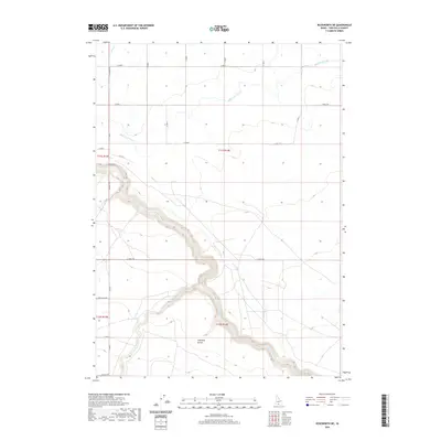
2020 Map of Roseworth NE
USGS Topo · Published 2020About this map
Salmon Falls Cr carves a deep, winding canyon through this high desert portion of Twin Falls County, defining the local geography. The creek’s steep-walled corridor contrasts with the organized agricultural grid established by the High Line Canal in the northern sections, showing the regional dependence on irrigation. In the southern reaches of the canyon, Antelope Pocket sits tucked within the sharp bends of the waterway, likely serving as a natural enclosure for early cattle movements.
Find a feature on this map
20 named features on this map. Tap any name to fly to it.
Don’t see what you’re looking for? This feature index may not catch every label — zoom into the map to look around manually.
Map Details
Editions of this 2020 Roseworth NE Map
This is the sole edition of this map. No revisions or reprints were ever made.
Other maps of this area

1950 · Jerome
USGS Topo · 1:62,500

1951 · Clover
USGS Topo · 1:24,000

1955 · Twin Falls
USGS Topo · 1:250,000

1958 · Twin Falls
USGS Topo · 1:250,000

1958 · Buhl
USGS Topo · 1:24,000

1959 · Buhl
USGS Topo · 1:62,500

1964 · Roseworth
USGS Topo · 1:24,000

1965 · Hollister SW
USGS Topo · 1:24,000

1965 · Roseworth SE
USGS Topo · 1:24,000

1965 · Roseworth NE
USGS Topo · 1:24,000