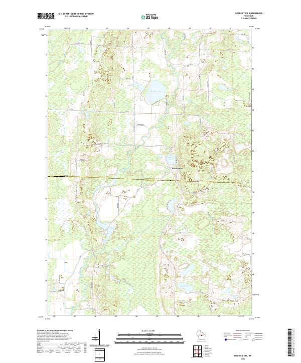
2022 Map of Rosholt NW
USGS Topo · Published 2022About this map
The Plover River meanders through a glaciated landscape defined by numerous kettle ponds and lakes along the border of Marathon and Portage counties. This 2022 survey captures the transition between the agricultural and forested lands surrounding Shantytown, a small settlement center where local routes like S Co Rd JY and Shantytown Dr converge. The topography is dominated by water features, including the prominent Big Bass Lake and Little Bass Lake, alongside smaller bodies like Wadley Lake and the Chain Lakes. A network of rural lanes such as Leather Camp Dr and Ice Age Ln provides access to these wetlands and wooded tracts, reflecting a modern landscape still shaped by the underlying moraine geology. Genealogists and local historians can use this map to trace the relationship between family property lines and the natural hydrology of the central Wisconsin drainage basin.
Find a feature on this map
60 named features on this map. Tap any name to fly to it.
Don’t see what you’re looking for? This feature index may not catch every label — zoom into the map to look around manually.
Map Details
Editions of this 2022 Rosholt NW Map
This is the sole edition of this map. No revisions or reprints were ever made.
Other maps of this area

1899 · Wausau
USGS Topo · 1:125,000

1902 · Wausau
USGS Topo · 1:125,000

1953 · Wausau
USGS Topo · 1:48,000

1953 · Hatley
USGS Topo · 1:48,000

1955 · Rosholt
USGS Topo · 1:48,000

1955 · Green Bay
USGS Topo · 1:250,000

1956 · Stevens Point
USGS Topo · 1:48,000

1963 · Wausau
USGS Topo · 1:62,500

1964 · Hatley
USGS Topo · 1:62,500

1969 · Rosholt
USGS Topo · 1:24,000