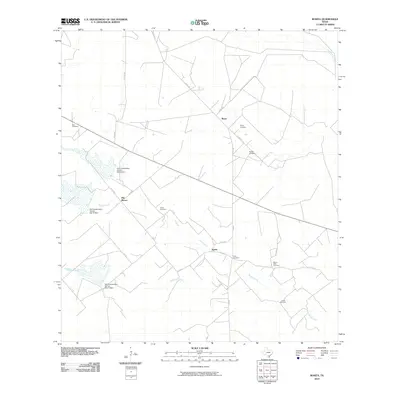
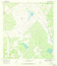
2010 Map of Rosita
USGS Topo · Published 2010About this map
Reyes, Pila Blanca, and Rosita anchor this rural landscape in Duval County, Texas, where the local economy and geography are defined by water management and family lineage. The map reveals an extensive network of small cemeteries, including Ruiz Cemetery, Rangel Cemetery, and Buena Vista Cemetery, which often signify long-standing ranching estates and family holdings in the South Texas brush country. Water infrastructure is a prominent feature of the landscape, with several Soil Conservation Service structures such as Soil Conservation Service Site 8 Dam and Soil Conservation Service Site 10 Dam positioned along Tarancahuas Creek and Rosita Creek. These sites, along with Hoffman Creek, illustrate the critical importance of drainage and erosion control in this region, where the vast web of county roads like Co RD 321 and FM 3196 connects isolated ranching communities.
Find a feature on this map
28 named features on this map. Tap any name to fly to it.
Don’t see what you’re looking for? This feature index may not catch every label — zoom into the map to look around manually.
Map Details
Editions of this 2010 Rosita Map
This is the sole edition of this map. No revisions or reprints were ever made.
Other maps of this area

1956 · Benavides
USGS Topo · 1:62,500

1956 · Rosita Ranch
USGS Topo · 1:62,500

1956 · Freer
USGS Topo · 1:62,500

1956 · Laredo
USGS Topo · 1:250,000

1968 · Benavides NW
USGS Topo · 1:24,000

1968 · Parrilla Creek NE
USGS Topo · 1:24,000
1968 · Benavides NE
USGS Topo · 1:24,000
1968 · Rosita
USGS Topo · 1:24,000
1969 · Rosita NE
USGS Topo · 1:24,000
1969 · Rosita NW
USGS Topo · 1:24,000