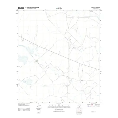
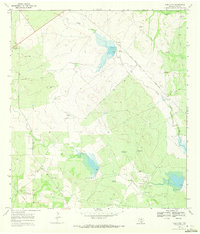
2013 Map of Rosita
USGS Topo · Published 2013About this map
Small family and community cemeteries define the landscape of south Texas in the 2010s, marking the heritage of local ranching and settlement across Duval County. Named for prominent local families, these sites include Reyes Cem, Alaniz Cem, and Buena Vista Cem, scattered throughout the brush country. The map centers on the small communities of Rosita and Reyes, where life is tied closely to the seasonal flow of drainages like Rosita Cr and Tarancahuas Cr. Agricultural infrastructure remains vital to this area, evidenced by landmarks such as the Llano Windmill and a network of county roads like Co RD-333 that connect remote homesteads. The concentration of private burial grounds near the settlements of Pila Blanca and Rosita provides a valuable geographic reference for genealogists tracing families in this part of the Rio Grande Plain.
Find a feature on this map
30 named features on this map. Tap any name to fly to it.
Don’t see what you’re looking for? This feature index may not catch every label — zoom into the map to look around manually.
Map Details
Editions of this 2013 Rosita Map
This is the sole edition of this map. No revisions or reprints were ever made.
Other maps of this area

1956 · Benavides
USGS Topo · 1:62,500

1956 · Rosita Ranch
USGS Topo · 1:62,500

1956 · Freer
USGS Topo · 1:62,500

1956 · Laredo
USGS Topo · 1:250,000

1968 · Benavides NW
USGS Topo · 1:24,000

1968 · Parrilla Creek NE
USGS Topo · 1:24,000
1968 · Benavides NE
USGS Topo · 1:24,000
1968 · Rosita
USGS Topo · 1:24,000
1969 · Rosita NE
USGS Topo · 1:24,000
1969 · Rosita NW
USGS Topo · 1:24,000