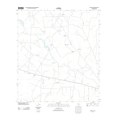
2013 Map of Rosita SE
USGS Topo · Published 2013About this map
The arid ranchlands of Duval County are defined by a network of ephemeral watercourses and vital infrastructure in this early 21st-century landscape. The San Diego Cr and Rosita Cr drain the territory, where water management is centralized at sites like the Muralla Tank. Cultural and genealogical history is anchored at the Sepulveda Cem, located near the intersection of several county roads. The area is dominated by large-scale landholdings, exemplified by the Robinson Ranch in the east. A striking feature of this map is the density of named water pumps, including the Sombrero Windmill, Alto Bonito Windmill, and El Norte Windmill. These landmarks illustrate the persistent necessity of groundwater access for livestock in a region where surface water is seasonal and sparse.
Find a feature on this map
28 named features on this map. Tap any name to fly to it.
Don’t see what you’re looking for? This feature index may not catch every label — zoom into the map to look around manually.
Map Details
Editions of this 2013 Rosita SE Map
This is the sole edition of this map. No revisions or reprints were ever made.
Other maps of this area

1917 · Ben Bolt
USGS Topo · 1:62,500

1920 · San Diego
USGS Topo · 1:62,500

1956 · Benavides
USGS Topo · 1:62,500

1956 · Rosita Ranch
USGS Topo · 1:62,500

1956 · Laredo
USGS Topo · 1:250,000

1963 · San Diego
USGS Topo · 1:24,000
1963 · Shaeffer Ranch
USGS Topo · 1:24,000

1963 · Ben Bolt NW
USGS Topo · 1:24,000

1968 · Benavides NW
USGS Topo · 1:24,000
1968 · Benavides NE
USGS Topo · 1:24,000