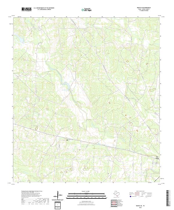
2022 Map of Rosita SE
USGS Topo · Published 2022About this map
Sepulveda Cem sits near the center of this landscape, a small family burial ground that anchors the local genealogy of rural Duval County. This South Texas brush country is defined by ephemeral waterways like San Diego Cr, Rosita Cr, and Toro Cr, which carve shallow paths through the terrain. The presence of Muralla Tank highlights the region's reliance on managed water resources for ranching and livestock in a semi-arid environment.
Find a feature on this map
22 named features on this map. Tap any name to fly to it.
Don’t see what you’re looking for? This feature index may not catch every label — zoom into the map to look around manually.
Map Details
Editions of this 2022 Rosita SE Map
This is the sole edition of this map. No revisions or reprints were ever made.
Other maps of this area

1917 · Ben Bolt
USGS Topo · 1:62,500

1920 · San Diego
USGS Topo · 1:62,500

1956 · Benavides
USGS Topo · 1:62,500

1956 · Rosita Ranch
USGS Topo · 1:62,500

1956 · Laredo
USGS Topo · 1:250,000

1963 · San Diego
USGS Topo · 1:24,000
1963 · Shaeffer Ranch
USGS Topo · 1:24,000

1963 · Ben Bolt NW
USGS Topo · 1:24,000

1968 · Benavides NW
USGS Topo · 1:24,000
1968 · Benavides NE
USGS Topo · 1:24,000