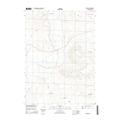
2015 Map of Ross Butte
USGS Topo · Published 2015About this map
The confluence of the Green River and the New Fork River defines this high-desert landscape in Sublette County. This 2015 topographic survey documents a region where river hydrology meets dramatic geological formations, such as the prominent Ross Butte and the extensive Ross Ridge. The terrain is marked by seasonal drainages including Alkali Cr and Granite Wash, which cut through the arid plains.
Find a feature on this map
23 named features on this map. Tap any name to fly to it.
Don’t see what you’re looking for? This feature index may not catch every label — zoom into the map to look around manually.
Map Details
Editions of this 2015 Ross Butte Map
This is the sole edition of this map. No revisions or reprints were ever made.
Other maps of this area

1939 · Big Piney
USGS Topo · 1:125,000

1942 · Big Piney
USGS Topo · 1:125,000

1955 · Preston
USGS Topo · 1:250,000

1955 · Lander
USGS Topo · 1:250,000

1958 · Lander
USGS Topo · 1:250,000

1958 · Preston
USGS Topo · 1:250,000

1961 · Lander
USGS Topo · 1:250,000

1962 · Preston
USGS Topo · 1:250,000

1964 · Two Buttes Reservoir
USGS Topo · 1:24,000

1964 · Ross Butte
USGS Topo · 1:24,000