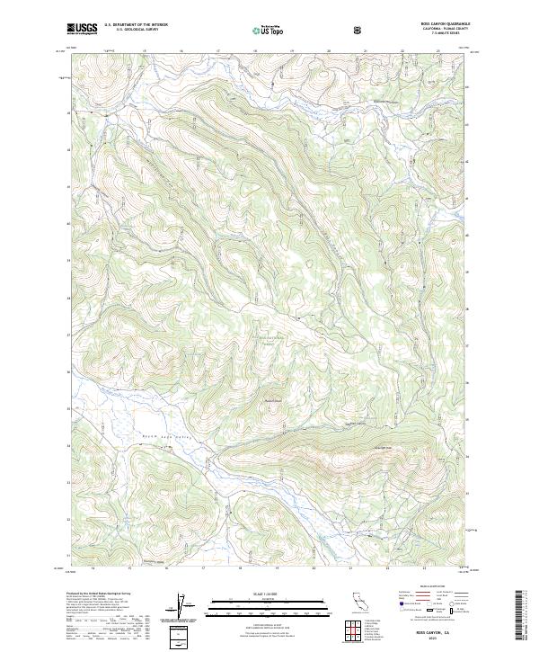
2023 Map of Ross Canyon
USGS Topo · Published 2023About this map
The Diamond Mountains dominate this high-altitude landscape within the Plumas National Forest, where the terrain transitions from steep canyons into the broad expanse of the Beyem Seyo Valley. This 2023 survey documents a remote watershed system including East Chance Creek and Rogers Creek, alongside several isolated water sources such as Oso Kum Spring and Om Chatim Springs. The presence of the Milford-Beckwourth road provides the primary corridor through this mountainous region, connecting the rugged peaks to lower elevations like Thompson Valley. The topography is defined by prominent summits including Mudum Peak and Delunga Peak, which overlook deep-cut drainage features like Siegfried Canyon and McClellan Canyon. This map serves as a contemporary record of the complex network of creeks and springs that sustain the forest's ecosystem and historical travel routes.
Find a feature on this map
25 named features on this map. Tap any name to fly to it.
Don’t see what you’re looking for? This feature index may not catch every label — zoom into the map to look around manually.
Map Details
Editions of this 2023 Ross Canyon Map
This is the sole edition of this map. No revisions or reprints were ever made.
Other maps of this area

1886 · Honey Lake
USGS Topo · 1:250,000

1890 · Sierraville
USGS Topo · 1:125,000

1891 · Downieville
USGS Topo · 1:125,000

1891 · Honey Lake
USGS Topo · 1:250,000

1892 · Sierraville
USGS Topo · 1:125,000

1893 · Honey Lake
USGS Topo · 1:250,000

1893 · Downieville
USGS Topo · 1:125,000

1894 · Sierraville
USGS Topo · 1:125,000

1895 · Downieville
USGS Topo · 1:125,000

1896 · Downieville
USGS Topo · 1:125,000