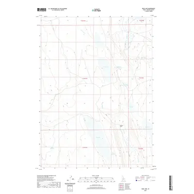
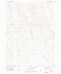
2020 Map of Ross Lake
USGS Topo · Published 2020About this map
Ross Lake and the intermittent drainages of Owyhee County define this high-desert basin in the state's southwestern corner. The landscape is characterized by a complex network of seasonal water storage and drainage, notably Ross Slough and several managed impoundments such as Yatahoney Reservoir Number 1 and Yatahoney Reservoir Number 2. These features, along with Henry Lake and Juniper Lake, illustrate the vital role of water management in a region where geographic names like Pleasant Valley and Mud Flat hint at the varying terrain. The map also records the presence of 903 Bia, a Bureau of Indian Affairs route, cutting through the southeastern sections. This survey provides a precise view of how modern ranching or land management infrastructure, including Willies Reservoir and Millin Reservoir, is overlaid upon the natural courses of Yatahoney Cr and Shoofly Cr.
Find a feature on this map
20 named features on this map. Tap any name to fly to it.
Don’t see what you’re looking for? This feature index may not catch every label — zoom into the map to look around manually.
Map Details
Editions of this 2020 Ross Lake Map
This is the sole edition of this map. No revisions or reprints were ever made.
Other maps of this area

1955 · Jordan Valley
USGS Topo · 1:250,000

1957 · Jordan Valley
USGS Topo · 1:250,000

1958 · Jordan Valley
USGS Topo · 1:250,000

1971 · Juniper Basin SE
USGS Topo · 1:24,000

1971 · Juniper Basin
USGS Topo · 1:24,000
1971 · Flying H Ranch
USGS Topo · 1:24,000
1971 · Jarvis Pasture
USGS Topo · 1:24,000
1971 · Mountain View Lake
USGS Topo · 1:24,000

1971 · Ross Lake
USGS Topo · 1:24,000
1972 · Nichol Flat
USGS Topo · 1:24,000