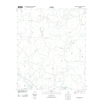
2012 Map of Ross Mountain
USGS Topo · Published 2012About this map
Center Ridge Cem and Center Ridge anchor the northwestern corner of this Palo Pinto County landscape, a terrain defined by isolated peaks and rugged drainages. The southern boundary is marked by the northern reaches of Possum Kingdom Lake, where Fillbuster Cr and Pinnington Cr drain into the reservoir. This modern topographic survey highlights a transition from traditional ranching lands to newer residential developments, as seen in the grid of roads near Cement Mtn, including Mountain Top Loop and Mountain Top Estates Rd. Named elevations like Ross Mtn, Bear Mtn, and Kisinger Mtn dominate the topography, while a network of rural routes such as Ross Valley Rd and House Ranch Rd connect the valleys and creek beds that have shaped the local economy and settlement patterns for generations.
Find a feature on this map
45 named features on this map. Tap any name to fly to it.
Don’t see what you’re looking for? This feature index may not catch every label — zoom into the map to look around manually.
Map Details
Editions of this 2012 Ross Mountain Map
This is the sole edition of this map. No revisions or reprints were ever made.
Other maps of this area

1890 · Breckenridge
USGS Topo · 1:125,000

1891 · Palo Pinto
USGS Topo · 1:125,000

1918 · Palo Pinto
USGS Topo · 1:125,000

1924 · Breckenridge 1-a
USGS Topo · 1:48,000

1924 · Palo Pinto 2-b
USGS Topo · 1:48,000

1924 · Palo Pinto 2-a
USGS Topo · 1:48,000

1924 · Graham 4-d
USGS Topo · 1:48,000

1927 · Graham
USGS Topo · 1:62,500

1927 · Pickwick
USGS Topo · 1:62,500

1931 · Ivan
USGS Topo · 1:62,500