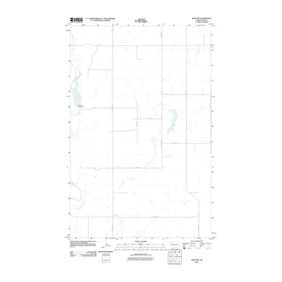
2011 Map of Ross NW
USGS Topo · Published 2011About this map
The White Earth River meanders through this section of Mountrail County, showing the drainage patterns of the northern prairie just before the end of the first decade of the 2000s. The landscape is defined by the White Earth Dam, which regulates the river's flow through the western portion of the quadrangle. This 2011 survey documents a sparsely populated agricultural region where the grid of section lines is maintained by a network of gravel and paved routes, including County Hwy-3111 and County Hwy-3011. The map captures the subtle topography of the Missouri Plateau, marked by numerous small wetlands and depressions characteristic of this glacial till plain. North-south transit is facilitated by local corridors such as 92nd Ave NW and 93rd Ave NW, which serve the various farmsteads and rural properties throughout the township.
Find a feature on this map
10 named features on this map. Tap any name to fly to it.
Don’t see what you’re looking for? This feature index may not catch every label — zoom into the map to look around manually.
Map Details
Editions of this 2011 Ross NW Map
This is the sole edition of this map. No revisions or reprints were ever made.
Other maps of this area

1953 · Williston
USGS Topo · 1:250,000

1957 · Williston
USGS Topo · 1:250,000

1969 · Ross NW
USGS Topo · 1:24,000

1969 · White Earth
USGS Topo · 1:24,000

1977 · Powers Lake
USGS Topo · 1:24,000

1978 · Battleview
USGS Topo · 1:24,000
1978 · Lunds Valley
USGS Topo · 1:24,000

1979 · Tioga SE
USGS Topo · 1:24,000

1981 · Ross
USGS Topo · 1:24,000

1981 · Manitou
USGS Topo · 1:24,000