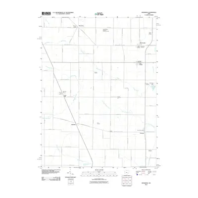
2010 Map of Rossburg
USGS Topo · Published 2010About this map
Eldora Speedway stands as a prominent cultural landmark in this agricultural landscape along the border of Darke and Mercer counties. The region is defined by a dense network of small rural settlements including Rossburg, Burkettsville, New Weston, and Sharpsburg, many of which maintain their own community services such as the Rossburg Post Office and Burkettsville Post Office. The terrain is characterized by a complex hydrographic system where the headwaters of the Wabash River and the Mississinewa River nearly meet, flowing alongside numerous drainage systems like Ward Ditch. For genealogists, the map is particularly detailed, locating several family and denominational burial sites including Zerby Cemetery, Webster Cemetery, and the Saint Pauls Catholic Cemetery. This intersection of religious heritage, local commerce at Hiestand Community Hall, and the enduring importance of the river forks illustrates the persistent rural structure of Western Ohio.
Find a feature on this map
79 named features on this map. Tap any name to fly to it.
Don’t see what you’re looking for? This feature index may not catch every label — zoom into the map to look around manually.
Map Details
Editions of this 2010 Rossburg Map
This is the sole edition of this map. No revisions or reprints were ever made.
Other maps of this area

1908 · St. Henry
USGS Topo · 1:62,500

1915 · Fort Recovery
USGS Topo · 1:48,000

1916 · Winchester
USGS Topo · 1:48,000

1918 · Winchester
USGS Topo · 1:62,500

1918 · Fort Recovery
USGS Topo · 1:62,500

1943 · Winchester
USGS Topo · 1:62,500

1953 · Muncie
USGS Topo · 1:250,000

1956 · Muncie
USGS Topo · 1:250,000

1960 · Union City
USGS Topo · 1:24,000

1960 · Fort Recovery
USGS Topo · 1:24,000