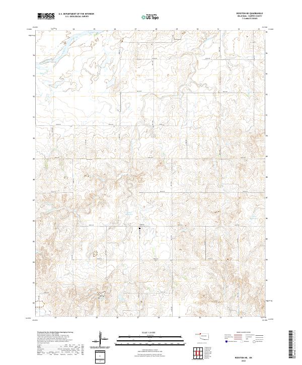
2022 Map of Rosston NE
USGS Topo · Published 2022About this map
The Cimarron River winds through the northwestern corner of this Harper County landscape, defining the local drainage system alongside its tributaries. Water management is a central theme of the terrain, evidenced by numerous numbered catchments including 05903 Reservoir and 05902 Reservoir that support the local agricultural and ranching economy. This rural expanse is organized by a precise grid of local roads, such as e0070 RD and n1810 RD, which facilitate movement between the intermittent creek beds of Redoubt Cr and Stink Cr. Near the center of the township lines, the Pleasant Valley Cem serves as a significant genealogical landmark, anchoring the area's history for researchers. The topographic data reveals a land of dissected plateaus and seasonal watercourses, reflecting the character of western Oklahoma's High Plains.
Find a feature on this map
29 named features on this map. Tap any name to fly to it.
Don’t see what you’re looking for? This feature index may not catch every label — zoom into the map to look around manually.
Map Details
Editions of this 2022 Rosston NE Map
This is the sole edition of this map. No revisions or reprints were ever made.
Other maps of this area

1894 · Sitka
USGS Topo · 1:62,500

1896 · Ashland
USGS Topo · 1:125,000

1955 · Woodward
USGS Topo · 1:250,000

1955 · Pratt
USGS Topo · 1:250,000

1958 · Woodward
USGS Topo · 1:250,000

1959 · Pratt
USGS Topo · 1:250,000

1970 · Buffalo NW
USGS Topo · 1:24,000
1970 · Rosston NW
USGS Topo · 1:24,000

1970 · Rosston NE
USGS Topo · 1:24,000

1970 · Buffalo
USGS Topo · 1:24,000