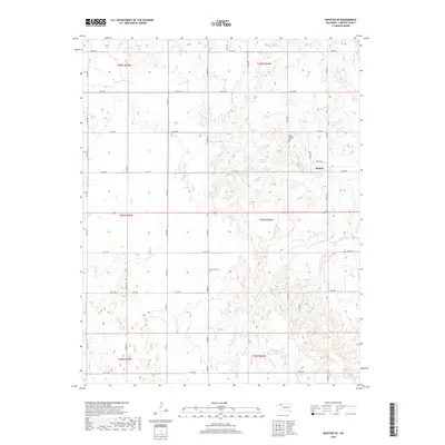
2018 Map of Rosston SE
USGS Topo · Published 2018About this map
Doby Springs Cem and Rose Hill Cem anchor this section of Harper County, providing essential locations for genealogists and local historians tracing families in the western Oklahoma plains. The landscape is defined by the winding course of Buffalo Cr, which cuts through a network of section-line roads such as e0130 RD and n1800 RD. Near the edge of the survey, the settlement of Buffalo serves as the local hub, while the 05934 Reservoir represents one of the few managed water sources in this arid environment. The map details the transition between various townships, including t27n r24w and t28n r24w, reflecting the rigid rectangular survey system that governed the settlement of the former Cherokee Outlet.
Find a feature on this map
34 named features on this map. Tap any name to fly to it.
Don’t see what you’re looking for? This feature index may not catch every label — zoom into the map to look around manually.
Map Details
Editions of this 2018 Rosston SE Map
This is the sole edition of this map. No revisions or reprints were ever made.
Other maps of this area

1955 · Woodward
USGS Topo · 1:250,000

1958 · Woodward
USGS Topo · 1:250,000

1970 · Buffalo NW
USGS Topo · 1:24,000
1970 · Rosston NW
USGS Topo · 1:24,000

1970 · Rosston NE
USGS Topo · 1:24,000

1970 · Buffalo
USGS Topo · 1:24,000

1971 · Rosston SE
USGS Topo · 1:24,000

1971 · Rosston
USGS Topo · 1:24,000

1971 · Fort Supply NW
USGS Topo · 1:24,000
1971 · Laverne
USGS Topo · 1:24,000