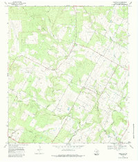
1968 Map of Rossville
USGS Topo · Published 1984About this map
The Atascosa River and its network of tributaries, including Agua Negra Creek and Santa Anna Creek, define the rural landscape of this South Texas region in the late 1960s. For genealogists, the map is remarkably dense with family-named burial grounds, such as Brite Cem, Lott Cem, Vanness Cem, and Alvarado Cem, reflecting generations of settlement near the riverbanks.
Find a feature on this map
30 named features on this map. Tap any name to fly to it.
Don’t see what you’re looking for? This feature index may not catch every label — zoom into the map to look around manually.
Map Details
Editions of this 1968 Rossville Map
2 editions found
Other maps of this area

1934 · Schattel
USGS Topo · 1:62,500

1942 · Natalia
USGS Topo · 1:62,500

1953 · Crystal City
USGS Topo · 1:250,000

1954 · San Antonio
USGS Topo · 1:250,000

1955 · Crystal City
USGS Topo · 1:250,000

1956 · Jourdanton
USGS Topo · 1:62,500

1957 · San Antonio
USGS Topo · 1:250,000

1958 · Somerset
USGS Topo · 1:24,000

1958 · Thelma
USGS Topo · 1:24,000

1961 · Crystal City
USGS Topo · 1:250,000