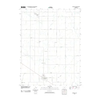
2009 Map of Rossville
USGS Topo · Published 2009About this map
Rossville serves as the primary hub in this Kansas landscape, situated at the intersection of a grid-like road network and established watercourses. The town's infrastructure is anchored by the Rossville Post Office and Rossville Cemetery, reflecting its role as a stable community center. Further north, the settlement of Delia marks another point of local significance, featuring the Delia Post Office near the winding path of Cross Creek.
Find a feature on this map
49 named features on this map. Tap any name to fly to it.
Don’t see what you’re looking for? This feature index may not catch every label — zoom into the map to look around manually.
Map Details
Editions of this 2009 Rossville Map
This is the sole edition of this map. No revisions or reprints were ever made.
Other maps of this area

1889 · Wamego
USGS Topo · 1:125,000

1889 · Topeka
USGS Topo · 1:125,000

1894 · Topeka
USGS Topo · 1:125,000

1894 · Wamego
USGS Topo · 1:125,000

1950 · Kansas City
USGS Topo · 1:250,000

1952 · Rossville
USGS Topo · 1:24,000

1952 · Silver Lake
USGS Topo · 1:24,000

1952 · Grove
USGS Topo · 1:24,000
1952 · Willard
USGS Topo · 1:24,000

1953 · Maple Hill
USGS Topo · 1:24,000