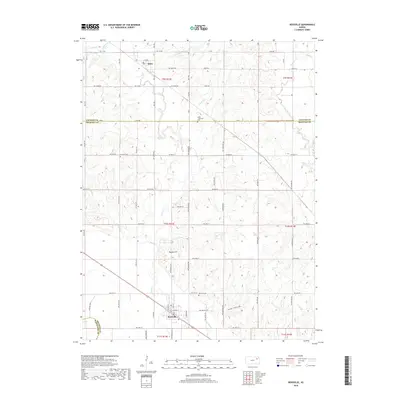
2018 Map of Rossville
USGS Topo · Published 2018About this map
Rossville serves as the primary hub in this Shawnee County landscape, situated near the intersection of the county lines with Wabaunsee and Jackson. The terrain is defined by a series of north-south drainages, including Cross Cr and Soldier Cr, which carve through the prairie towards the Kansas River valley. Cultural markers such as the Czech - Moravian Cem and Franklin Cem indicate the deep-rooted immigrant and settler heritage of this agricultural region. Distinctive local landmarks like Peanaz Hill and the curiously named Toad Hollow provide specific geographic points of interest within the grid of township roads. Further north, the small settlement of Delia stands near the Jackson County line, while the Rossville Cem sits just north of its namesake town, offering a detailed view of the community's established footprint in the early 21st century.
Find a feature on this map
44 named features on this map. Tap any name to fly to it.
Don’t see what you’re looking for? This feature index may not catch every label — zoom into the map to look around manually.
Map Details
Editions of this 2018 Rossville Map
This is the sole edition of this map. No revisions or reprints were ever made.
Other maps of this area

1889 · Wamego
USGS Topo · 1:125,000

1889 · Topeka
USGS Topo · 1:125,000

1894 · Topeka
USGS Topo · 1:125,000

1894 · Wamego
USGS Topo · 1:125,000

1950 · Kansas City
USGS Topo · 1:250,000

1952 · Rossville
USGS Topo · 1:24,000

1952 · Silver Lake
USGS Topo · 1:24,000

1952 · Grove
USGS Topo · 1:24,000
1952 · Willard
USGS Topo · 1:24,000

1953 · Maple Hill
USGS Topo · 1:24,000