
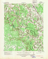
1935 Map of Rotan
USGS Topo · Published 1942About this map
Bartholomew Bayou meanders across this alluvial landscape, defining the boundaries between Lincoln, Desha, and Drew Counties. The 1935 environment is one of extensive wetland systems and timber operations, evidenced by the numerous brakes and sloughs like Gibson Brake and Bear Slough, alongside the rail-dependent economies of the Missouri Pacific RR. The map records a dense network of local landmarks, including the Indian Mounds near the bayou and timber company infrastructure such as the Simpson Veneer & Lumber Co.
Find a feature on this map
96 named features on this map. Tap any name to fly to it.
Don’t see what you’re looking for? This feature index may not catch every label — zoom into the map to look around manually.
Map Details
Editions of this 1935 Rotan Map
2 editions found
Other maps of this area

1935 · Feenyville
USGS Topo · 1:62,500

1935 · Cominto
USGS Topo · 1:62,500

1935 · Varner
USGS Topo · 1:62,500

1935 · Noble Lake
USGS Topo · 1:62,500

1935 · Red Fork
USGS Topo · 1:62,500

1935 · Gillett
USGS Topo · 1:62,500

1936 · McGehee
USGS Topo · 1:62,500

1937 · McGehee
USGS Topo · 1:62,500

1948 · Helena
USGS Topo · 1:250,000

1950 · Helena
USGS Topo · 1:250,000