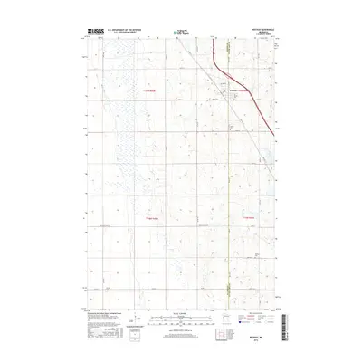
2016 Map of Rothsay
USGS Topo · Published 2016About this map
The boundary between Wilkin and Otter Tail counties bisects the prairie landscape surrounding the settlement of Rothsay. This 2016 survey shows the community clustered along the primary transportation corridor of Co Hwy 52, with the legacy of the region's original travel routes still visible in the alignment of Old Hwy 52. The township's rural character is defined by a dense grid of section roads, including Co Rd 16 and Co Rd 19, which provide access to scattered homesteads and agricultural tracts.
Find a feature on this map
33 named features on this map. Tap any name to fly to it.
Don’t see what you’re looking for? This feature index may not catch every label — zoom into the map to look around manually.
Map Details
Editions of this 2016 Rothsay Map
This is the sole edition of this map. No revisions or reprints were ever made.
Other maps of this area

1913 · Fergus Falls
USGS Topo · 1:62,500

1914 · Pelican Rapids
USGS Topo · 1:62,500

1917 · Pelican Rapids
USGS Topo · 1:62,500

1919 · Rothsay
USGS Topo · 1:62,500

1919 · Barnesville
USGS Topo · 1:62,500

1951 · Rothsay
USGS Topo · 1:62,500

1952 · Barnesville
USGS Topo · 1:62,500

1953 · Fargo
USGS Topo · 1:250,000

1956 · Fargo
USGS Topo · 1:250,000

1966 · Carlisle
USGS Topo · 1:24,000