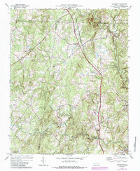
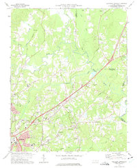
1974 Map of Rougemont
USGS Topo · Published 1987About this map
The Norfolk and Western railroad corridor serves as the central spine for this 1974 survey, connecting the small Piedmont communities of Rougemont and Bahama. This landscape is defined by the intersection of three North Carolina counties—Person, Orange, and Durham—where the drainage basins of the Flat River and the Little River converge. The mapping of Orange Factory and the nearby George K Slocum Forestry Camp highlights the region's historical ties to early industry and conservation. Local life is well-documented through a network of country churches and schools, such as New Bethel Ch, Mount Grove Ch, and the Mangum Sch. From the heights of Red Mountain down to the creek beds of Buffalo Creek and Deep Creek, the map provides a clear record of the rural road networks and property boundaries that shaped this part of the Research Triangle's northern periphery before modern suburban expansion.
Find a feature on this map
26 named features on this map. Tap any name to fly to it.
Don’t see what you’re looking for? This feature index may not catch every label — zoom into the map to look around manually.
Map Details
Editions of this 1974 Rougemont Map
3 editions found
Other maps of this area

1943 · Roxboro
USGS Topo · 1:62,500

1951 · Durham North
USGS Topo · 1:62,500

1953 · Greensboro
USGS Topo · 1:250,000

1954 · Greensboro
USGS Topo · 1:250,000

1962 · Greensboro
USGS Topo · 1:250,000

1966 · Greensboro
USGS Topo · 1:250,000
1968 · Hillsborough
USGS Topo · 1:24,000

1968 · Caldwell
USGS Topo · 1:24,000

1968 · Hurdle Mills
USGS Topo · 1:24,000
1973 · Northeast Durham
USGS Topo · 1:24,000