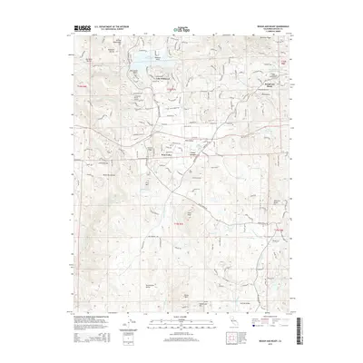
2015 Map of Rough And Ready
USGS Topo · Published 2015About this map
Rough and Ready stands as a focal point in this portion of Nevada County, where residential development and historic land divisions meet the foothills. The area is defined by a complex network of water management features, including the Tarr Ditch, Bald Hill Ditch, and Smith-Gordon Ditch, which traverse the landscape alongside natural waterways like Squirrel Cr and Deer Cr. These man-made ditches speak to the region's enduring reliance on diverted water for agriculture and local industry. To the west, Lake Wildwood serves as a prominent modern landmark, while the surrounding terrain is marked by family-named features such as Joe Miller Ravine and Haney Mtn. The map also details the smaller hubs of Penn Valley and Casey Corner, illustrating the transition from open ranch land like the area around American Ranch Hill to more concentrated settlements and local infrastructure like the Limbertost Ranch Airport.
Find a feature on this map
91 named features on this map. Tap any name to fly to it.
Don’t see what you’re looking for? This feature index may not catch every label — zoom into the map to look around manually.
Map Details
Editions of this 2015 Rough And Ready Map
This is the sole edition of this map. No revisions or reprints were ever made.
Other maps of this area

1888 · Smartsville
USGS Topo · 1:125,000

1891 · Smartsville
USGS Topo · 1:125,000

1892 · Smartsville
USGS Topo · 1:125,000

1894 · Smartsville
USGS Topo · 1:125,000

1895 · Smartsville
USGS Topo · 1:125,000

1915 · Spenceville
USGS Topo · 1:31,680

1941 · Bangor
USGS Topo · 1:62,500

1944 · Bangor
USGS Topo · 1:62,500

1948 · Nevada City
USGS Topo · 1:62,500
1948 · Oregon House
USGS Topo · 1:24,000